


Dendron Voting District, Surry County, Virginia
About
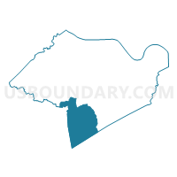
Outline

Summary
| Unique Area Identifier | 682623 |
| Name | Dendron Voting District |
| County | Surry County |
| State | Virginia |
| Area (square miles) | 32.91 |
| Land Area (square miles) | 32.64 |
| Water Area (square miles) | 0.27 |
| % of Land Area | 99.19 |
| % of Water Area | 0.81 |
| Latitude of the Internal Point | 37.01032400 |
| Longtitude of the Internal Point | -76.92943180 |
Maps


Graphs
Select a template below for downloading or customizing gragh for Dendron Voting District, Surry County, Virginia


Neighbors
Neighoring Voting District (by Name) Neighboring Voting District on the Map
- Blackwater Voting District, Sussex County, VA
- Carsley Voting District, Surry County, VA
- Ivor Voting District, Southampton County, VA
- Mars Hill Voting District, Sussex County, VA
- Wakefield Voting District, Sussex County, VA
- Wall's Bridge Voting District, Surry County, VA
Top 10 Neighboring County Subdivision (by Population) Neighboring County Subdivision on the Map
- Berlin and Ivor district, Southampton County, VA (2,984)
- Waverly district, Sussex County, VA (2,924)
- Wakefield district, Sussex County, VA (1,853)
- Carsley district, Surry County, VA (1,375)
- Dendron district, Surry County, VA (1,370)
Top 10 Neighboring Place (by Population) Neighboring Place on the Map
Top 10 Neighboring Unified School District (by Population) Neighboring Unified School District on the Map
- Southampton County Public Schools, VA (18,570)
- Sussex County Public Schools, VA (12,087)
- Surry County Public Schools, VA (7,058)
Top 10 Neighboring State Legislative District Lower Chamber (by Population) Neighboring State Legislative District Lower Chamber on the Map
Top 10 Neighboring State Legislative District Upper Chamber (by Population) Neighboring State Legislative District Upper Chamber on the Map
Top 10 Neighboring 111th Congressional District (by Population) Neighboring 111th Congressional District on the Map
Top 10 Neighboring Census Tract (by Population) Neighboring Census Tract on the Map
- Census Tract 2001, Southampton County, VA (4,251)
- Census Tract 8602, Surry County, VA (3,651)
- Census Tract 8703, Sussex County, VA (2,861)
- Census Tract 8704, Sussex County, VA (1,767)